Lighthouses of the Isle of Wight
With a unique position nestled within the double high tide of the Solent, the Isle of Wight has served as a major navigational landmark since becoming separated from the mainland around 7,000 years ago.
From ancient trade routes right through to the busy shipping lanes of today, it’s no surprise to find lighthouses on the Island’s edges, warning seafarers of rocky shores, and each lighthouse boasts a fascinating history. Keep reading to find out more!
St Catherine’s Oratory
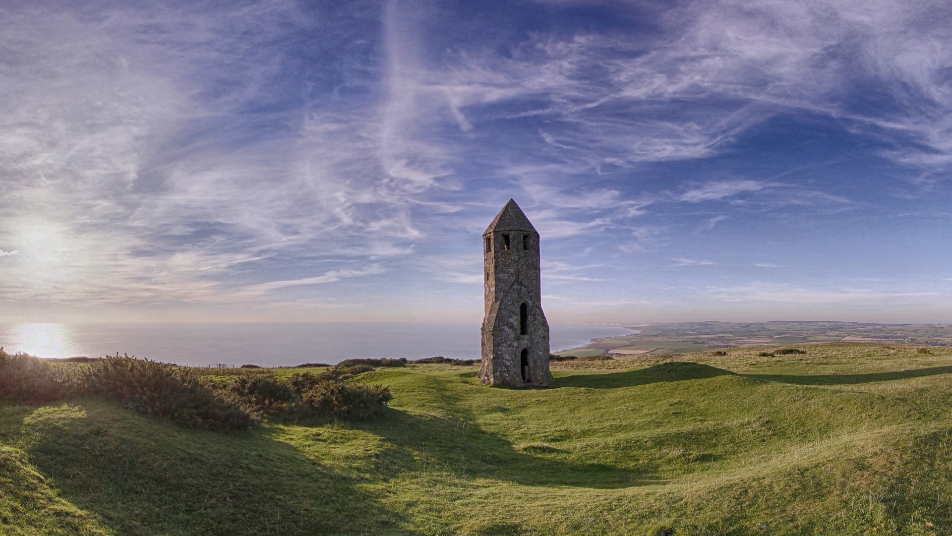
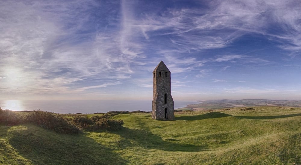
Dating back to 1328, St Catherine’s Oratory is known to locals as ‘The Pepperpot’ due to its unusual shape, akin to that of a pepper shaker. The pepperpot is Britain’s only surviving medieval lighthouse, and the second oldest in the UK, behind the Roman Lighthouse in Dover. It’s believed to have been built by local landowner and Lord of Chale, Walter de Godeton, as penance for allegedly plundering a nearby shipwreck in 1314 and taking wine that was due to be delivered to a monastery in France. As a result, the church threatened him with excommunication if he did not build a lighthouse on St Catherine’s Down, using fire to warn passing ships. While its position provides sweeping sea views on a clear day, visibility would often be hindered by fog, and the decision was made to build a new lighthouse nearer to sea level on St Catherines Point, relieving The Pepperpot of its duties.
St Catherine’s Lighthouse
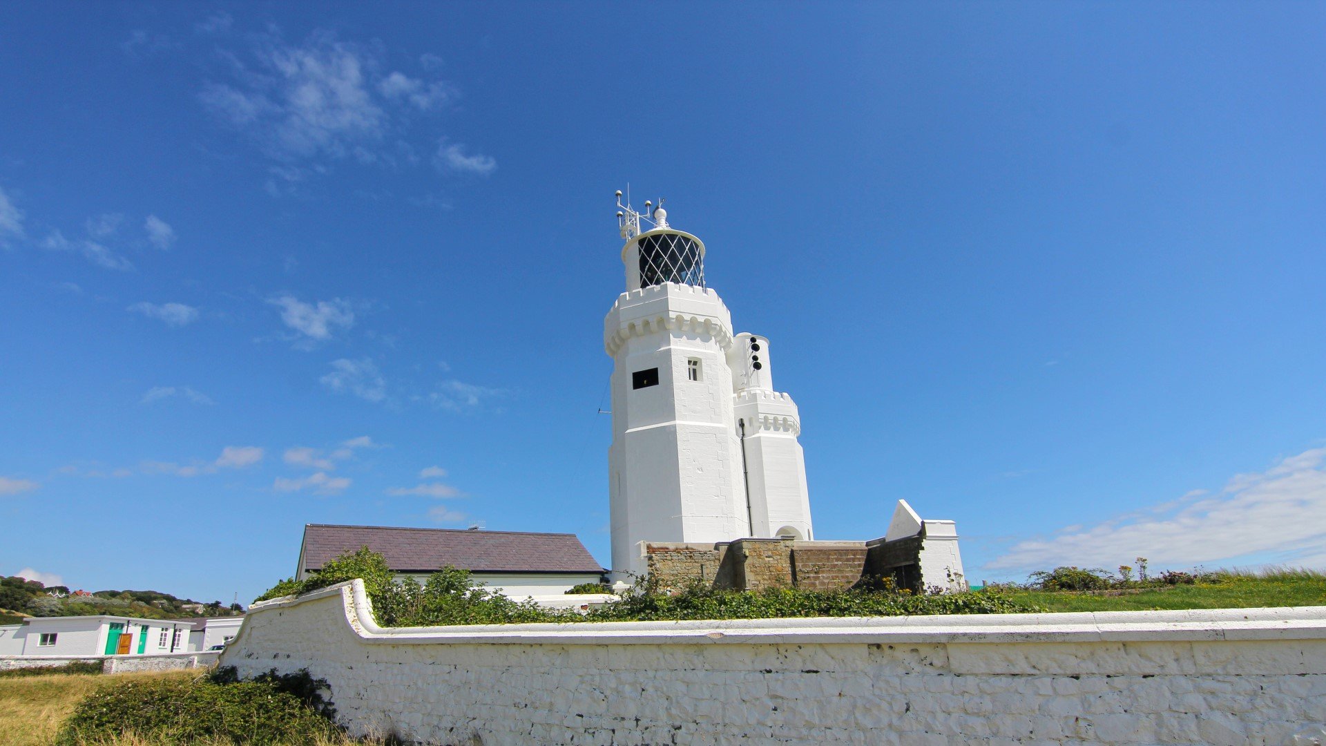
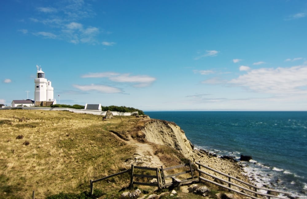
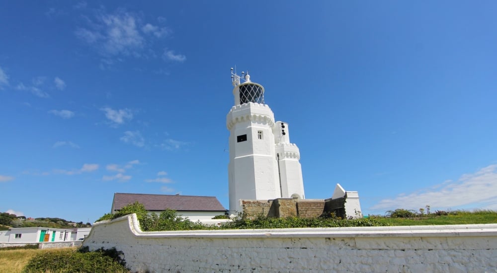
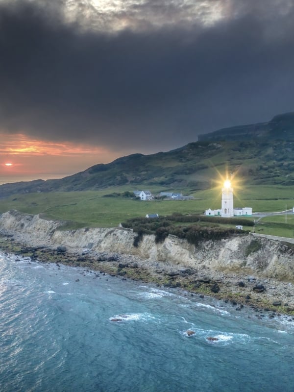
The 1836 wreckage of SV Clarendon, a disaster which saw 25 fatalities, highlighted the requirement for a lighthouse nearer the rocks below Blackgang Chine. The sailing ship was on her way back from the West Indies carrying sugar and rum when tumultuous waves tossed her to shore, and she reportedly broke up in just ten minutes. By 1840, the present lighthouse had been built to prevent future disasters, along with a fog signal house. The original lantern was oil fuelled until advances in technology led to the decision to convert to electric power in the 1880s. By 1932 the fog signal house had deteriorated and was rebuilt as a second, smaller, adjoining tower, housing a more powerful siren. Tragedy befell the lighthouse in 1943, when a Luftwaffe bombing raid destroyed the engine house and killed the three keepers on watch at the time - William Jones, Richard Grenfell and Charles Tompkins – all buried together in a dedicated grave at the local church in Niton. St Catherine’s Lighthouse became automated in 1994, and now serves as a weather reporting station for the Met Office. An idyllic spot on the Island’s south coast, a visit can be perfectly paired with a pitstop at nearby former smugglers haunt, The Buddle Inn, and cottages on the grounds can be rented by holidaymakers.
The Needles Lighthouse
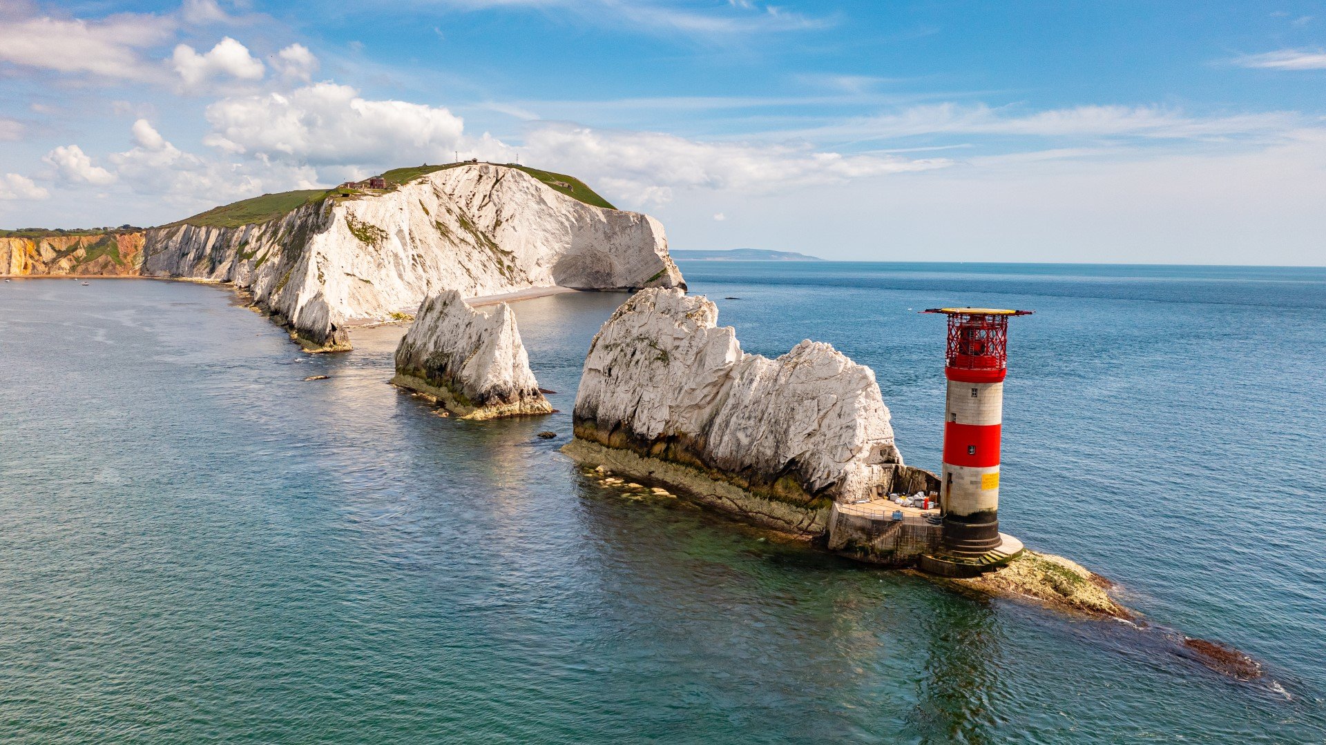
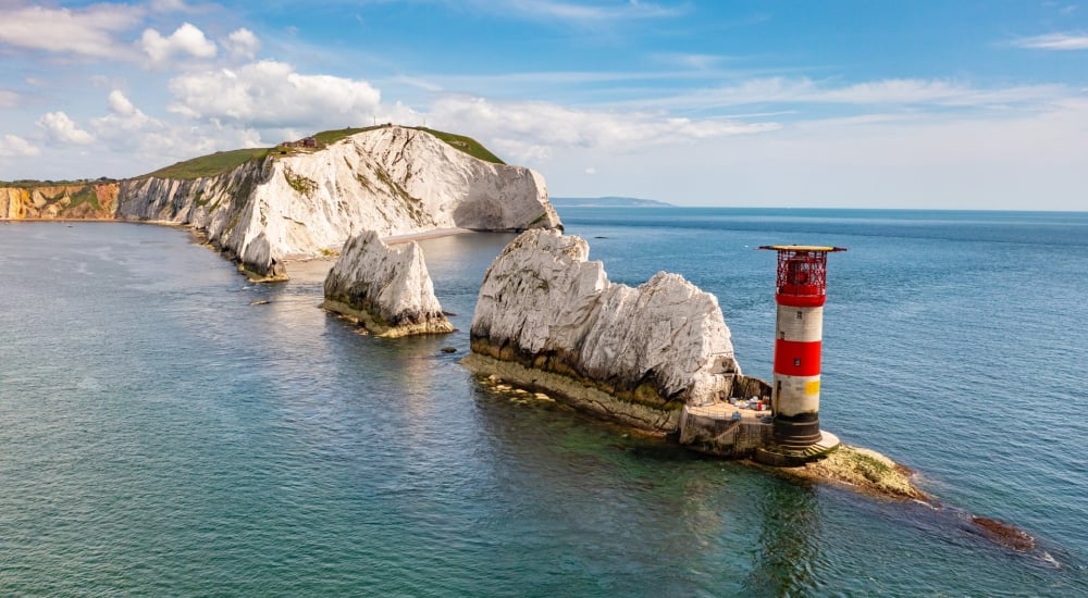
The need for a navigational light on the western approach to the Island was identified in 1781, when a group of merchants and seafarers petitioned to Trinity House. Construction began on the first lighthouse in 1785, on the cliff above the Needles rocks. However, being 151m above sea level proved to be an issue with fog and sea mist hugging the clifftop, obscuring the light. Plans were made to replace the lighthouse, and excavations began to create a level base for a second tower on the outer edge of the rocks, with tunnels inside the rocks to be used for storage. This second lighthouse, that survives to this day, was first lit on 1 January 1859, and didn’t take on its trademark red and white stripes until 1886 when the plain granite was painted. In the years between the lighthouse has seen several light changes and even sustained some damage in the second World War, requiring substantial repairs. Originally staffed by a 3-man crew on 24 hour watch, the lighthouse became automated in 1994, although maintenance is regularly carried out with engineers deployed via helicopter. Nearby, you’ll also find the Needles Battery, built in the 19th century to defend against French invasion. The tunnels are now open to the public and offer panoramic views of the Needles, the Solent and the English Channel, as well as a fascinating glimpse into Britain’s historical coastal defences.
Nab Tower Lighthouse

Situated in the eastern Solent, the Nab Tower was constructed during WWI to assist in defending the south coast from German U-boats. Originally designed to be one of eight outposts linked together by steel nets, plans were halted when the conflict came to an end in 1918, leaving the admiralty to find an alternative use for the tower. It was decided that it would replace the Nab lightship, which had been in place since 1812. The 27m tall structure was towed by steam tugs to Nab rocks, where it settled on the seabed at an angle of 3 degrees, giving it a visible tilt to the northeast. The tower would finally see action in WWII, where its strategic location and possession of Borfors guns allowed for the downing of three enemy aircraft. The offshore lighthouse became automated in 1983 and is now operated from a Trinity House control room in Harwich, Essex.
Egypt Point Lighthouse
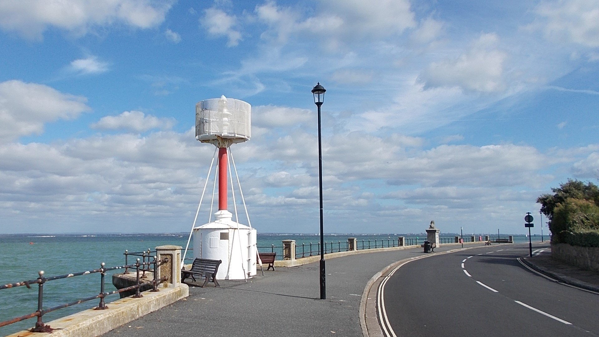
Between the towns of Cowes and Gurnard lies Egypt Point, the name believed to derive from nearby gypsy encampments of the 16th century. One of Queen Victoria’s favourite beauty spots, the location marks the northernmost point of the Island, surrounded by the Solent and its busy shipping channels. As such, between 1897 and 1989 the spot was marked by a basic lighthouse, which was initially lit with paraffin and later converted to electricity in 1969. As technology in the maritime industry advanced, the lighthouse was no longer deemed necessary, and it was decommissioned in 1989. Today just the base remains, with the lantern stored at ALK Lighthouse Museum in Hurst Castle on the mainland.
For more Island inspiration, see our Explore section.
Find Ways To Save.
Book your ferry travel to the Isle of Wight today!


